

If you begin with a simple drawing of your existing landscape, known as a base map, you lay the groundwork for an organized approach to more doable and affordable landscape improvements.
Take your time with this important step. Subsequent drawings -- the site analysis and the conceptual, preliminary, and final designs -- all use the base map as a starting point. The accuracy of the base map makes it a dependable tool, which in turn helps ensure the success of any project, large or small.
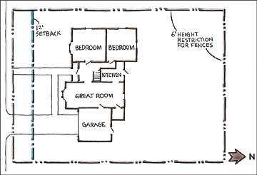
continue reading belowFirst, obtain a map that shows the exact size and shape of your property. This may be the plat, a deed map, the architect's or builder's plans, or a topographical plan with contour lines showing the site's elevation or gradations. The map should include the fixed structures and hardscape -- the house, driveway, sidewalks, fences, walls -- and their measurements.

Plats are useful for locating easements on a property, but not every state plats lots. Depending on where you live, a plat may have been included in the papers you acquired when purchasing your home. If not, you may be able to obtain it from the city or county assessor's office. There may be a fee for this service. While you are asking for a plat of your property, also ask for a copy of all local ordinances regarding easements, height restrictions, and any other regulations that may have an effect on your landscaping project.
Make several copies of the plat; label and store the original in a safe place. Then get ready to create your base map by gathering a few materials that will make the task easier: a 100-foot tape measure, plenty of sharp pencils, graph paper, and tracing paper. As you measure your property, follow the tips on the next page.
Make sure the measurements on your map are accurate; mark any changes on a copy of the plat map. Measure the outside dimensions of the lot, house, garage, and any other major structures or hardscape areas. Record the measurements.
Use the techniques listed below to develop an accurate base map of your yard. This map will be the basis of all of your landscape planning.
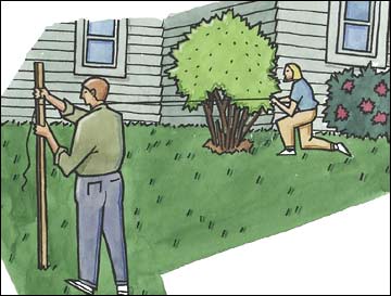
 To locate a structure or plant,
measure from two know locations,
then mark on your map where the
two distances intersect.
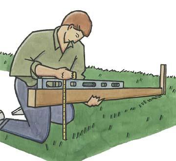
 To measure a slope, fix one endof a long, straight board, thenhold the board level andmeasure the drop at thedownslope end.
Copyright © www.100flowers.win Botanic Garden All Rights Reserved